|
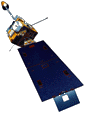
The NOAA Geostationary Operational Environmental Satellites (GOES) is an operational weather satellite used for monitoring weather in the western hemisphere. GOES is in a geosynchronous orbit and is about 35,800 km above the Earth. GOES-8 (EAST) is positioned at 75 W, while GOES-10 (West) is positioned at 135 W. The GOES (-8, -10) Imager is five channel radiometer (1 visible, & 4 infrared) with wavelengths centered at 0.65um to 12.0um. The routine GOES Imager Schedule (from NOAA OSO) scans the CONUS every 15 minutes. GOES imagery on this website updates at about 24 and 54 minutues after the hour.
|
|
|