Air Traffic Shutdown Study
Contents
- Air Traffic Denisty.
- News articles and related publications.
- Satellite Contrail Imagery.
1. Air Traffic Denisty:
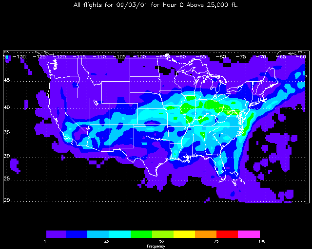
- Hourly flight traffic on 09/03 (normal). (GIF animation)
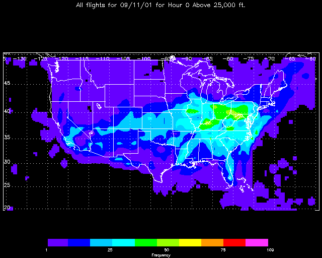
- Hourly flight traffic on 09/11 (suspended). (GIF animation)
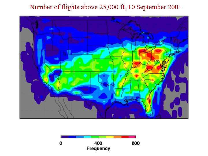
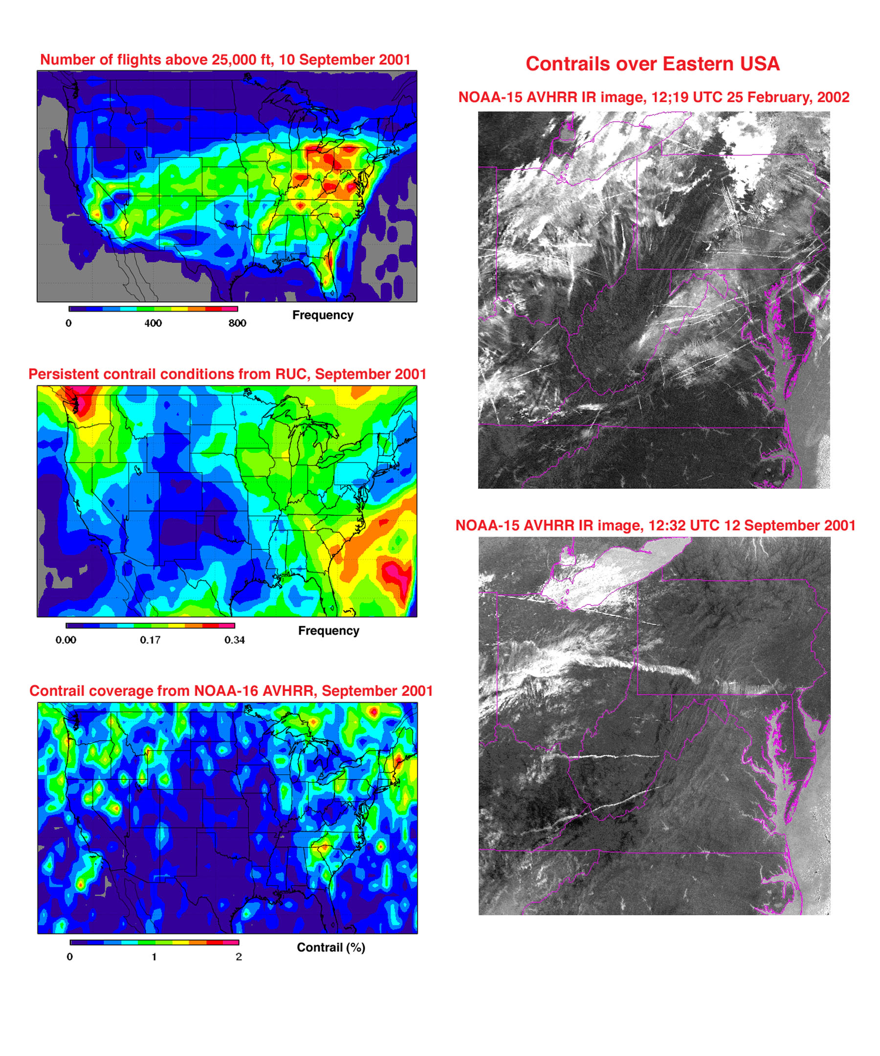
- Number of flights above 25,000 ft, 10 September 2001.
2. News articles and related publications:
- Minnis, P., L. Nguyen, D. P. Duda and R. Palikonda, 2002: " Spreading of isolated contrails during the 2001 air traffic shutdown ". Proc. 10th Conference on Aviation, Range, and Aerospace Meteorology, Portland, OR, May13-16, 2002.
- Cover of AVRAMS Conference Proceedings.
- The Weather Channel segment on contrails. (Windows Media Player needed)
- October 30, 2001 NY Times article on post-Septmber 11th contrail studies.
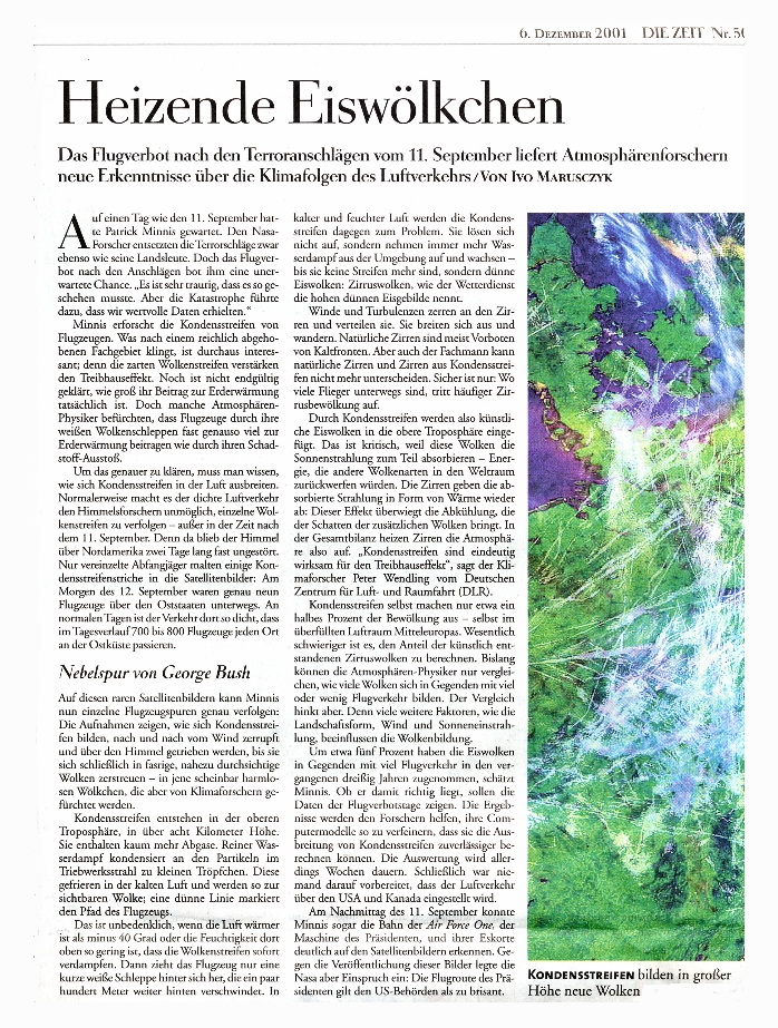
- December 6, 2001 DIE ZEIT article on contrail (in german).
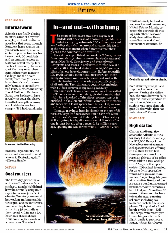
- May 27, 2002 US News & World Report article on contrails.
- September 17, 2002 NY Times article on post-Septmber 11th contrail studies.
3. Satellite Contrail Imagery:
-
September 11, 2001.
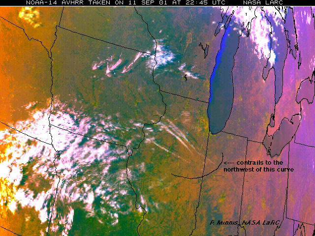
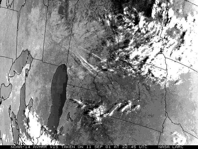
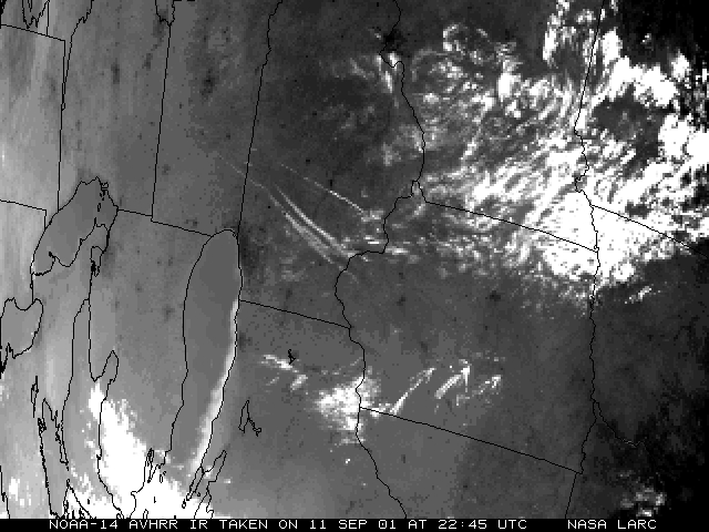
- AVHRR images, color, VIS, IR, showing contrails over Illinois that may be from the President's fighter-escorted flight from Offutt Air Force Base in Omaha back to Washington.
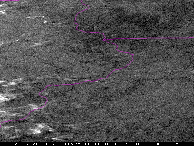
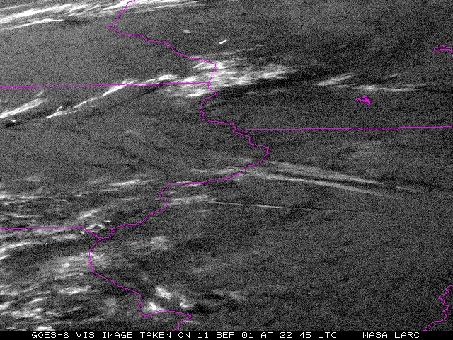
- Hi-res GOES VIS imagery at 21:45 and 22:45 showing contrails over midwestern USA.
- GOES-8 satellite imagery movie shows the aftermath of the terrorist attack on New York City World Trade Center on 11 September 2001. courtesy: Louis Nguyen LaRc,NASA
-
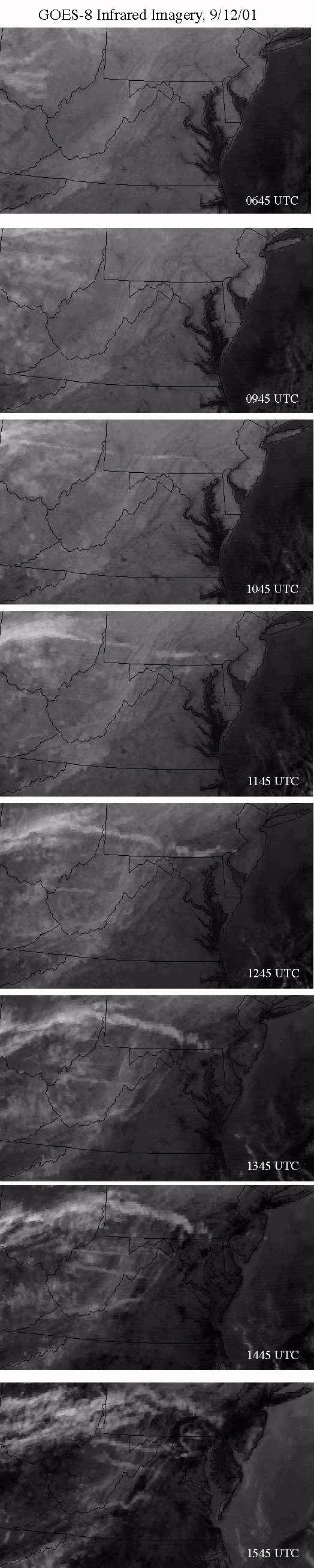
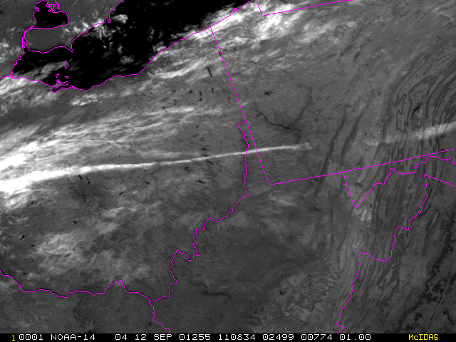
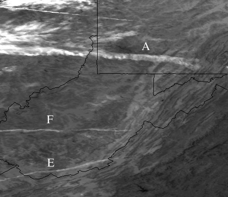
September 12, 2001.
- GOES IR sequence of contrails over northeastern USA.
- MODIS VIS and IR images of contrails over northeastern USA.
- AVHRR IR 1-km image, at 11:08 UTC (NOAA-14) and 12:4 UTC (NOAA-15) over northeastern USA.
- Simulation of contrails on Septmber 12 for normal air traffic. (Quicktime format)
This page last modified on 30 Sep, 2002